 Freelance
Traveller
Freelance
TravellerNeptune Station: Undersea Research Facility, University, and Community
This was the featured article in the June 2015 issue. In order to keep page loading time and memory requirements reasonable, the article has been broken up into several pages. Even so, viewing these pages is not recommended on download links with speeds less than 1Mbps, and true broadband capability is strongly recommended.
Main Habitat Dome
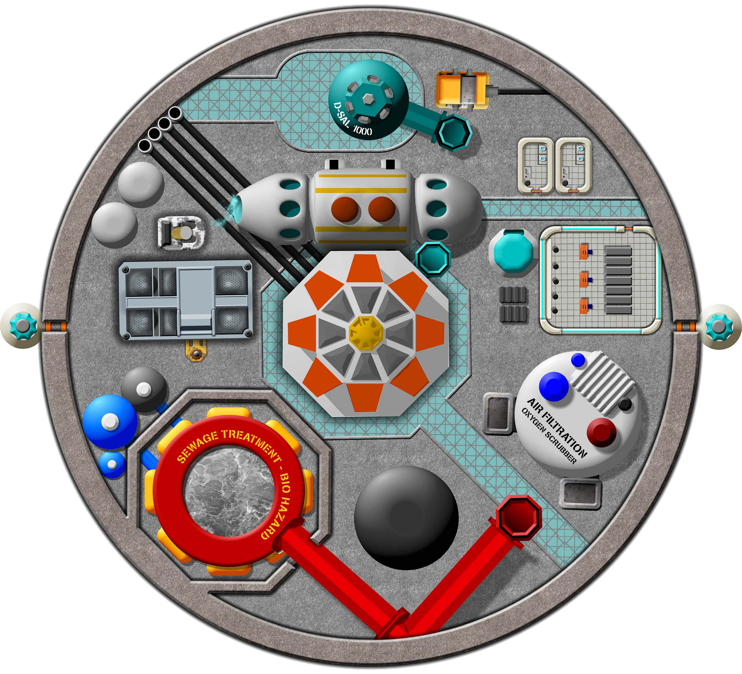
Industrial Operations Level
The lowest level of the main habitat structure, located beneath the fifth habitat level is the industrial operations level. Here all the life support systems are contained included sewage treatment, sea water desalination systems, air purification, and the station’s geothermal power plant using the excavated volcanic structures within the seamount beneath the station. A full control room for all systems sit to the east side of this level. Adjacent to this office is the maintenance elevator. Two escape pods exist for the workers on this level.
-
Main Dome: Community and University Levels -
Main Dome: Warehouse/Maintenance Level -
Main Dome: Habitat Levels -
Main Dome: Industrial Operations Level -
Ancillary Domes: Moon Pool and Observation Platform -
Ancillary Domes: Hydroponics Dome -
Ancillary Domes: Marine Laboratory
Editor’s Note: Neptune Station has been released commercially by the author as a set of maps for Virtual Tabletop systems such as Roll20, at $3.99 from DrivethruRPG. The commercial products are at higher resolution than the maps presented here.
Author’s Note: if you ignore the undersea aspects in the areas surrounding the main map, as well as finding an alternative to the moon pool, and oceanography dome, this facility could easily work as a planetary space station on an airless or exotic atmosphere environment, so it’s doesn’t solely have to serve as an undersea facility. This map can be more versatile than that.
The commercial versions of the mapped station are currently scaled at 1 inch = 10 feet. The large, main map measures 72×72 inches, so from edge to edge the area shown depicts 720 feet making the station an entire, compact undersea town and really quite extensive. This means rescaling it to 1 inch = 5 feet would rescale the dimensions to be 144×144 inches, meaning you would have to divide this map into 4 quarters to display on platforms like Roll20. At the 1 inch = 5 feet scale, even the sublevels and the main habitat level would be larger than 72×72, so a single full level couldn’t be displayed in its entirety on a Roll20 screen.